Tornadoes touch down in area
A thunderstorm that barreled through the region Sunday evening ahead of a cold front resulted in two brief tornado touchdowns in this area.
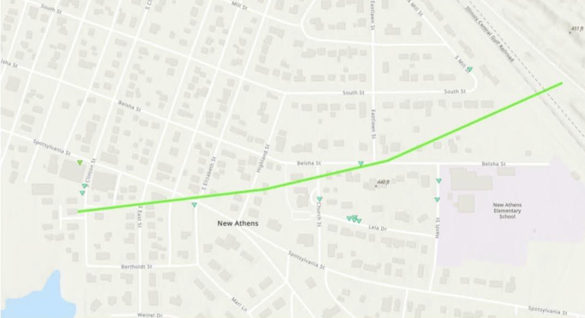
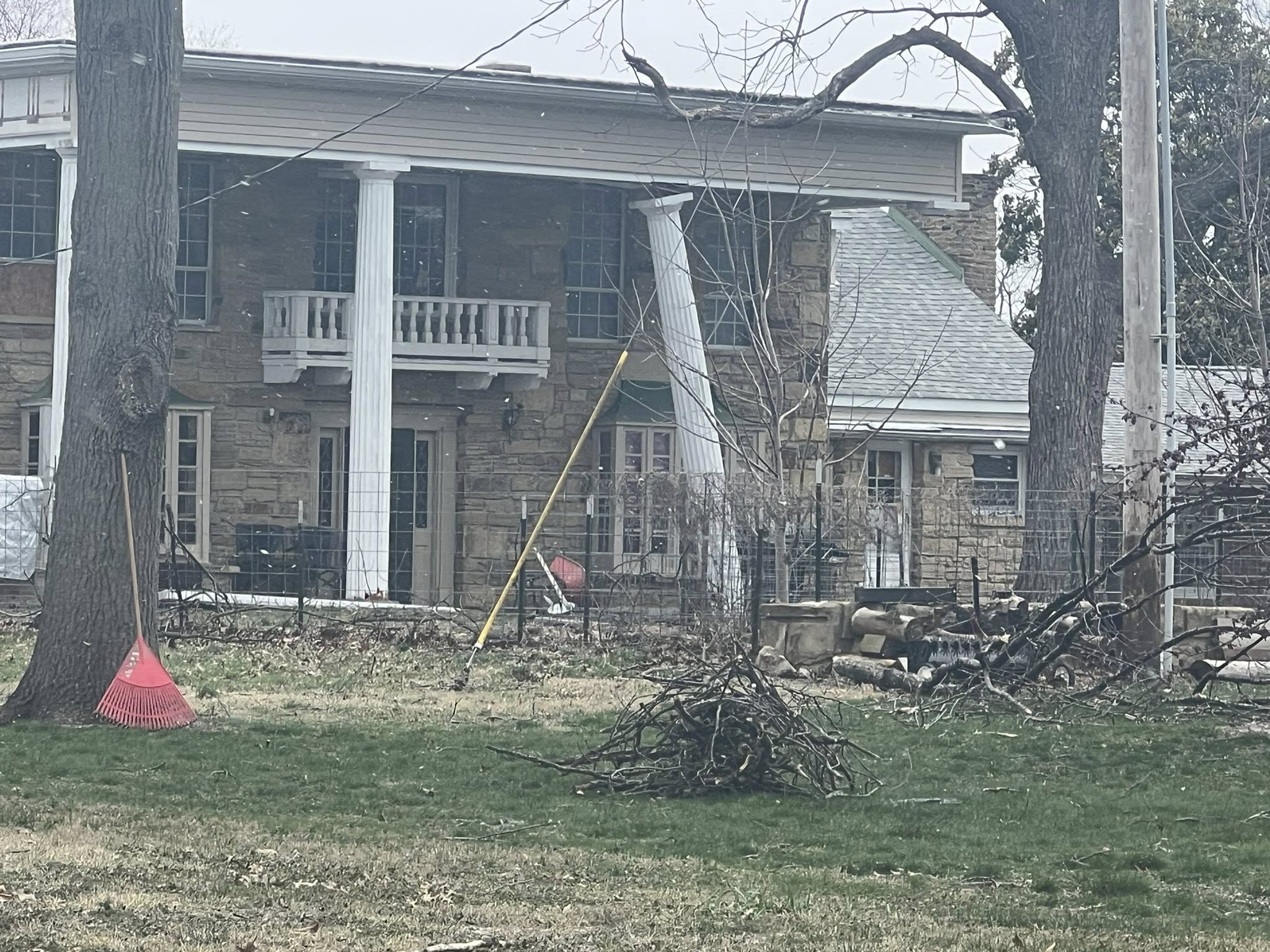
The National Weather Service in St. Louis confirmed Monday morning that an EF-1 tornado landed just west of New Athens at 5:47 p.m. Sunday, causing damage to a few structures and trees before lifting just east of town. Per a map provided by the weather service, this tornado touched down on Clinton Street just south of Spotsylvania Street and continued east before lifting just north of New Athens Elementary School.
Per the weather service, the path of the tornado measured .58 miles in length with a maximum wind speed of 90 miles per hour and a maximum width of 225 yards.
Fortunately, no injuries were reported in this weather incident.
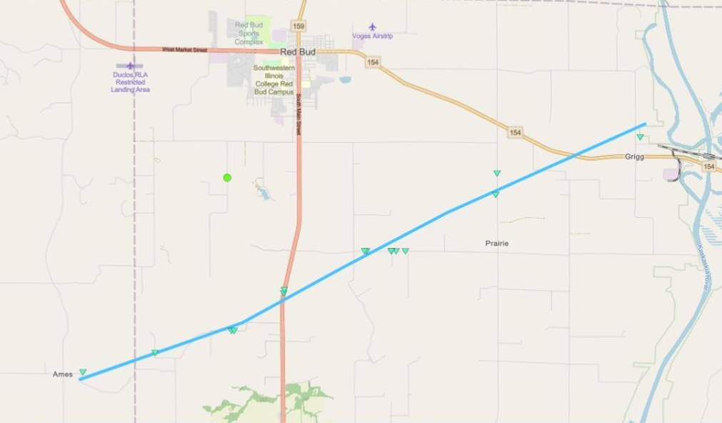
Also on Monday, the NWS confirmed that an EF-0 tornado touched down at 5:35 p.m. just north of Ames at the far eastern border of Monroe County. This minor twister traveled northwest into Randolph County for about 8.7 miles with a maximum wind speed of 85 miles per hour, lifting just north of Griggs less than 10 minutes later.
There was damage reported as a result of this small tornado, mostly to trees and outbuildings. There was roof damage reported to Trinity Lutheran Church located at 10247 South Prairie Road southeast of Red Bud, per the weather service.


