A school board township tutorial

With the April 4 election on the horizon, one rather archaic aspect of local elections has come up, thanks chiefly to the substantial number of candidates running for Waterloo School Board.
On the ballot, school board candidates will be separated into three sections with only a certain number of board seats available in each section.
Of the four candidates running in Township 2S Range 9W, a maximum of three could be appointed. Among Township 2S Range 10W, only one of the two can be appointed, while all three candidates from Township 3S Range 10W could be appointed.
These limits ensure that only three members of the board come from one specific township and range in the community.
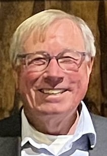
This system of townships and ranges is likely to be somewhat confusing for those only encountering the terms when they come up every school board election, but for retired professional engineer and land surveyor Rodney Linker, this system holds a rich and fascinating history.
“I have been involved in surveying for most of my professional career,” Linker said, “and the interesting aspects of it are the way it evolved here in the United States and some of the history that preceded this system.”
As a relatively simple explanation, townships are rectangular chunks of land that are roughly 6 square miles each.
Township is used as a general term to describe these chunks, though it’s also used to describe horizontal groups of townships on a map while the term range is used to denote vertical groups.
With this in mind, a map of townships shows Township 2S Range 9W makes up the northwest quadrant of Waterloo and beyond, also dipping into St. Clair County.
Township 2S Range 10W is to the east with its bottom-left corner at Valmeyer, and Township 3S Range 10W is to the south of that with its southern edge at Maeystown.
This system of dividing land – referred to as the Public Land Survey System – is now overseen by the Bureau of Land Management, but Linker dug deep into the history of the system.
Meridians – lines of longitude running north and south – were used as the starting point when the PLSS was being developed during the late 18th and 19th centuries.
Linker said the third principal meridian, which runs through Centralia, was used as the starting point to survey much of Illinois.
As Linker said, surveyors followed a set of instructions provided by the General Land Office for how to mark their position and, armed with a magnetic compass, did a rather impressive job in marking the smaller subsections of townships.
“They went to these locations and just started a line and tried to stay on a north alignment,” Linker said, “and certainly in those days the instrumentation was a little different than we’re used to today.”
Linker said these surveyors placed stone markers every half mile, also making note of any witness trees or other landmarks to identify their position.
These markers were first established from north to south, then east to west outward from the nearest principal meridian.
Many of these markers still stand to this day, and as Linker said, they are still viewed as an authoritative map of townships across the country.
“Certainly there were errors,” Linker said, “but today, the monuments that those original surveyors set take precedent over any other recorded dimension or bearing.”
Linker further explained some of the oddities visible on a PLSS map.
While Monroe County is divided in a rather routine way, townships bordering Missouri draw their border along the Mississippi River.
Even more strange townships can be seen across the river, with St. Louis, Festus, Mo., and other communities defying the township grid with bizarre shapes of varying sizes.
Linker said such borders were due, in part, to land ownership precedent from prior to the PLSS’s establishment. Odd borders could also be due to commerce and transportation of the time.
Regardless of some strange outlines, Linker said the PLSS impacts much of how we live today.
The school board is a pertinent example each election, but counties in general also draw their borders based on the PLSS.
“Everyone’s personal real estate is tied back to this system in some fashion or another,” Linker said. “The county boundaries sometimes butted rivers. There was purpose in the way they divided those counties, but it varied by necessity.”


